
Last updated: September 21, 2026
This Da Nang surf report combines the My Khe surf forecast, live camera and local morning beach check. Conditions can differ along the city beach as wind exposure and sandbanks change.
Da Nang surf conditions
My Khe Beach reference point
Loading current forecast…
Current model forecast · not a beach sensor
Waiting for data
Typical October · 1.08 m @ 6.7 s · prevailing NE
Waiting for data
Typical October · 11.4 km/h · prevailing N
Sea-surface temperature
Typical October · 29.4°C
See My Khe now
Live/replay · 20 secActual view at one section of My Khe. Powered by Da Nang Surf Cam · Support the camera
See what changes
Interactive forecastModel map for the wider Da Nang coast. Forecast map by Windy.
Next 6 hours
Wave · period · windLoading forecast…
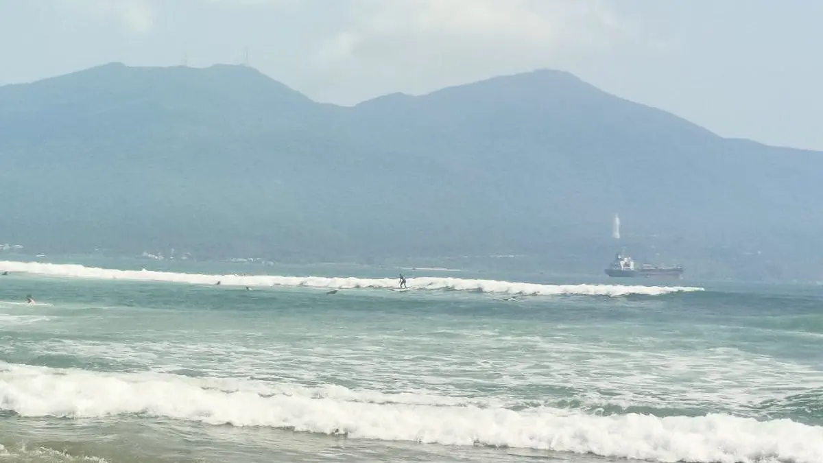
The forecast shows what is approaching the coast; the camera shows how one My Khe bank is breaking right now.
Is Da Nang Worth Surfing Today?
A useful window usually combines enough energy, manageable wind and a bank producing repeatable shoulders. The numbers narrow the timing; the camera reveals the shape.
Light or easing wind and repeatable open peaks usually matter more than one impressive number. Rising onshore gusts can turn extra energy into messier surf, while a small clean bank may still suit a longboard or softboard. Longer-period and storm pulses bring more power and longer lulls. At the beach, the largest sets, current, entry and exit matter more than the average frame on the camera.
How to Read Today’s Da Nang Surf Conditions
Each reading answers a narrow question. Together they describe likely energy, timing and surface quality; none predicts the exact breaking face, current or depth.
| Reading | Meaning |
|---|---|
| Wave height | Overall energy in the combined sea state near Da Nang |
| Mean period | General spacing and organisation of the waves |
| Wave direction | Average approach direction of the combined wave field |
| Wind and gusts | Likely surface quality and shore effect |
| Next six hours | Whether the window is improving or fading |
| Live camera | Actual shape and set pattern at one visible bank |
| Water temperature | Thermal comfort |
| Tide | How the current bank may change with water level |
Wave Height and Period: Read Them Together
Wave height describes the significant height of the combined sea state, not the face of every breaking wave or the largest set. The displayed period is the mean wave period, not peak period. At the same modelled height, a longer mean period usually brings more widely spaced and organised energy.
Broad Da Nang tendencies:
- About 4–6 seconds: short, closely spaced wind-driven waves, often weak or disorganised.
- About 6–8 seconds: common in Da Nang and often surfable with a clean surface and useful bank.
- About 8–10 seconds: more organised and energetic, with clearer sets.
- Above 10 seconds: less common, with longer lulls and potentially much stronger sets.
A smaller, organised wave field can surf better than a larger short-period one.
Wave Direction: How Directly Is Energy Reaching My Khe?
My Khe faces broadly east, so northeasterly through easterly energy often reaches the city beach more directly. The panel shows the average direction of the combined wave field, not automatically the primary swell; Sơn Trà, local bathymetry and shifting sandbanks can all alter the result.
Wind and Gusts: Is the Surface Improving?
At this east-facing reference point, westerly wind is broadly offshore, easterly wind onshore, and northerly or southerly wind more cross-shore. Shoreline angle and beachfront buildings can change the effect locally. Gusts matter as much as the average: a moderate reading with sharp gusts can still make take-offs messy.
Tide and Moving Sandbanks
There is no single best tide for the whole of My Khe. One bank may become fast and shallow at lower water while another loses shape near high tide. Storms can move peaks and rip channels within a short time.
Tide is not included in the live panel. The Da Nang tide table provides the water level; our guide to reading a beach break in Da Nang explains the visible clues.
Da Nang Surf Spots & Wind Anatomy Map
Choose the Right Surf Plan for Your Level
First Session or Returning After a Long Break
Orderly whitewater, space and an easy entry matter more than the largest visible peak. Anyone not yet confident reading currents and the biggest sets will be better served by a supervised session.
See beginner surf lesson options in Da Nang
Independent Beginner
Small, clean peaks or controlled whitewater, a clear exit and room away from swimmers are the useful signs. The live view shows shape, but not current or depth.
See the beginner surfing guide and softboard rental options.
Intermediate and Experienced Surfers
Mean period, direction, gusts and set spacing usually say more than a single score. Repeating open shoulders matter more than one good wave, and nearby sections may handle the same energy differently. Longer-period or storm pulses bring longer lulls and larger sets; the Da Nang surf spots map provides wider coastal context.
Forecast vs Camera: What to Trust When They Disagree
The model describes the sea approaching the coast. The camera shows how one visible sandbank is handling it. When they disagree, the difference is useful information.
| Mismatch | Likely explanation |
|---|---|
| Energetic forecast, flat preview | The preview may fall between sets, the direction may miss that bank, or the offshore grid may not match the shorebreak |
| Modest forecast, rideable peaks | A clean surface and well-shaped bank are making the most of limited energy |
| Favourable wind label, textured surface | Local wind, gusts, cross-sea or beachfront buildings differ from the model point |
| The visible bank is closing out | That sandbar is poorly aligned; a nearby section may work differently |
| Dark, offline or unclear camera | No visual confirmation; the latest My Khe morning update may add local context |
A 20-second preview may miss the set. The full stream is more useful when the numbers and first frame disagree.
When to Surf: Read the Next Six Hours
- Wind eases while energy holds: the surface may improve.
- Energy rises with stronger onshore or cross-onshore gusts: bigger but often messier.
- Wave height and period fade: the earlier window may be better.
| Range | Best use |
|---|---|
| Now–6 hours | Session timing |
| 1–3 days | Choosing a likely day and approximate time |
| 4–7 days | Following a possible swell trend |
| 8+ days | General planning rather than precise timing |
Da Nang Monthly Surf Averages
The 2022–2025 baseline gives seasonal context for the current readings.
| Month | Typical model wave | Typical wind | Water |
|---|---|---|---|
| January | 1.09 m @ 7.0 s · NE | 10.1 km/h · NE | 23.7°C |
| February | 1.01 m @ 6.5 s · NE | 11.8 km/h · NE | 23.8°C |
| March | 0.75 m @ 5.8 s · E | 10.3 km/h · SE | 24.5°C |
| April | 0.68 m @ 5.4 s · E | 11.3 km/h · SE | 26.0°C |
| May | 0.52 m @ 5.8 s · E | 8.9 km/h · S | 28.3°C |
| June | 0.34 m @ 4.9 s · E | 8.4 km/h · S | 30.7°C |
| July | 0.33 m @ 5.3 s · E | 7.8 km/h · SW | 30.4°C |
| August | 0.31 m @ 5.4 s · E | 8.0 km/h · S | 31.3°C |
| September | 0.48 m @ 6.4 s · E | 7.6 km/h · SW | 30.9°C |
| October | 1.08 m @ 6.7 s · NE | 11.4 km/h · N | 29.4°C |
| November | 1.18 m @ 7.0 s · NE | 11.2 km/h · NE | 27.2°C |
| December | 1.35 m @ 7.1 s · NE | 12.5 km/h · NE | 25.2°C |
October through February is the most energetic period in this dataset. March through May generally eases; June through September is usually smaller, apart from occasional storm-related pulses. These are model averages for comparison, not beach measurements or long-term climate normals.
For broader trip planning, see the month-by-month Vietnam surf season guide.
Typhoon and Post-Storm Surf
Tropical systems can send extra energy toward Da Nang, but that does not guarantee clean surf. Longer lulls can hide stronger sets, wind can change quickly, and storms can move both sandbanks and rip channels.
Do not surf during an official storm warning, beach closure or lightning. After a storm, currents, debris, runoff, access and the sandbanks may all have changed; yesterday’s peak may no longer exist.
Before You Paddle Out at My Khe
- Allow for the largest sets, current and sideways drift—not only the average wave.
- Know the entry and exit; check the leash and fins and keep control of the board.
- Respect lifeguards, flags, swimmer zones and closures; stay clear of nets, float lines and boats.
- Stay out for lightning, debris, runoff, unusual colour or smell, or conditions beyond your ability.
If You Are Caught in a Rip Current
Rip currents may appear as a gap in breaking waves, a channel of choppy or differently coloured water, or foam and debris moving away from shore, but they are not always easy to identify. Do not fight directly toward the beach. Float or tread water, signal for help and, if you can swim safely, move parallel to shore or toward breaking waves until clear of the current, then return at an angle. Follow lifeguard instructions and never rely on the camera to identify a safe channel. See NOAA’s rip-current guidance.
Thunder and Lightning
If you hear thunder, leave the water immediately and move into an enclosed building or hard-topped vehicle. Moving only farther up the beach is not adequate lightning protection. See the National Weather Service lightning guidance.
Data Sources and Limits
- Forecast data: marine and wind values delivered by Open-Meteo for the reference point 16.061, 108.247. Variables include significant wave height, mean period, combined direction, wind and sea-surface temperature. Model selection and grid position can vary.
- Timing: the panel uses a 20-minute cache. Its timestamp is the forecast time in ICT (UTC+7), not a beach-sensor reading or the article’s editorial update time.
- Local context: Da Nang Surf Cam covers one section of My Khe. Windy provides the wider map, while tide is referenced separately from a local coastal table.
- Monthly baseline: 2022–2025 model values compiled by SlicedWaves for seasonal comparison, not a long-term climate normal.
Da Nang Surf Forecast FAQ
Why does this forecast differ from Surfline or Windguru?
Services can use different models, grid points, update times and definitions. For example, one may display mean period while another highlights peak period or a swell component.
Is My Khe suitable for beginners today?
Look for manageable whitewater, space away from other beach users and a straightforward entry and exit. Conditions that suit an experienced surfer may still be unsuitable for a first session; when in doubt, go with an instructor.
When is the main surf season in Da Nang?
Surf is generally more frequent from October or November through February or March. In the 2022–2025 SlicedWaves baseline, October through February has the highest typical wave heights.
Do I need a wetsuit in Da Nang?
The baseline ranges from about 23.7°C in January to 31.3°C in August. Boardshorts or swimwear with sun protection work for many surfers; a thin top or spring suit can be useful on cooler, windy mornings.
Plan Your Next Da Nang Session
Need help turning the forecast into a session?